GIS Day is an annual event celebrating the technology of geographic information systems (GIS) that was initiated by spatial analytics world-leader Esri, and which first took place in 1999. GIS is a scientific framework for gathering, analyzing, and visualizing geographic data to help us make better decisions. GIS Day helps others learn about geography and the real-world applications of GIS that are making a difference in our society.
At Pennoni, we believe an asset management strategy allows owners and operators to know not only where their assets are located but also how the assets are performing. Depending on the assets, our project teams strategize with asset owners and operators to develop a comprehensive strategy through GIS mapping or enterprise asset management (EAM) solutions. Using the data collected, owners can improve operations, reduce costs, ensure regulatory compliance, and extend asset life and value. Pennoni is also an ESRI Silver Partner.
In the past year Pennoni has been growing its portfolio in Environmental GIS tremendously. The GIS team is regularly involved with a range of environmental projects, including non-motorized transportation mapping, environmental and species protection, and large-scale climate change analysis.
Some project highlights include:
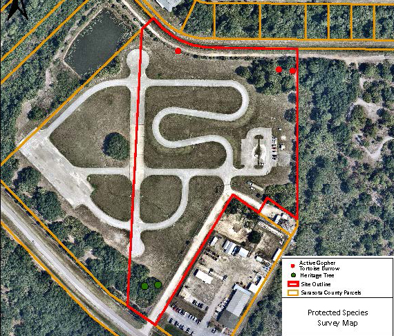 Identifying Burrowing locations for Protected Gophers, Tortoises, and Owls
Last November, Pennoni’s Cape Coral, FL Environmental Group digitized their field data collection efforts, utilizing ArcGIS Collector. Since implementation, the group has collected the locations of more than 600 protected Gopher Tortoise burrows, Burrowing Owl burrows, and heritage tree locations. After locating, the team then determines if the protected species is within harm’s way of active construction, and if so, they are relocated to a protected site.
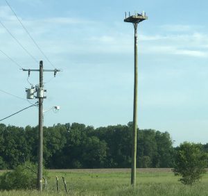
Avian Data Collection
Pennoni’s Survey team traveled to Eastern Maryland to locate potential bird nests on utility poles using ArcGIS Collector. Pennoni worked with the utility company and an Avian Specialist to make sure nests were safely removed to avoid a service issue or injured animal.
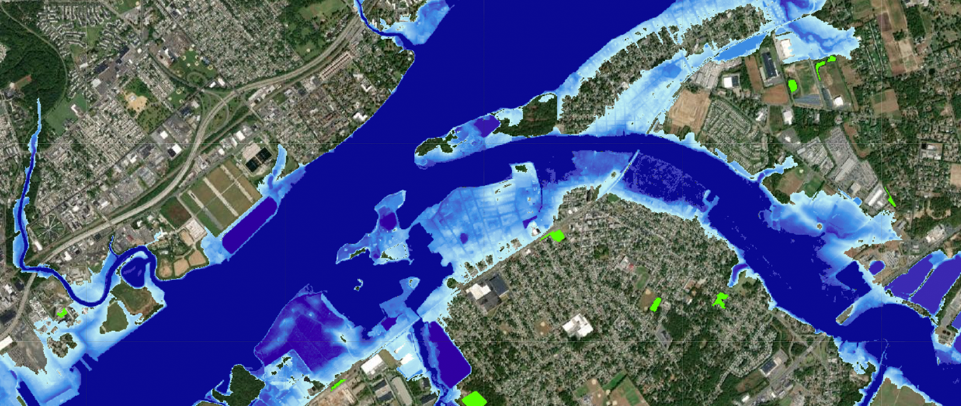
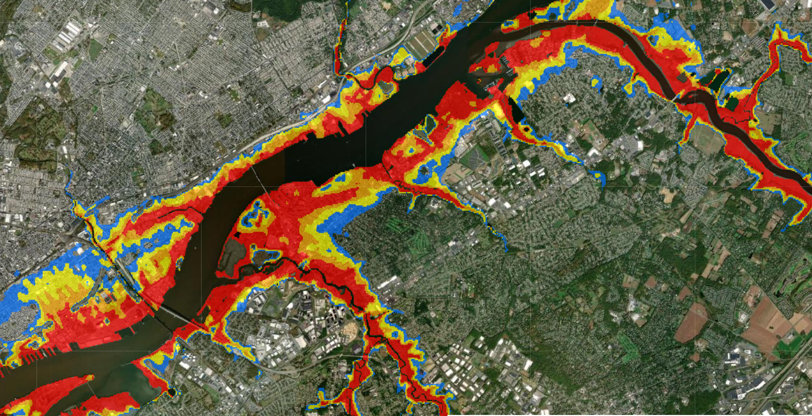 Climate Change Analysis
Many of our clients are looking to understand how their assets may be affected by climate change. Pennoni uses GIS to synthesize the most up-to-date research data with in-field analysis to evaluate present and future vulnerabilities, focusing on Sea Level Rise, Extreme Weather Events, Temperature Change, and Air Quality.

For more information, contact Matt Quackenbush, GISP at mquackenbush@pennoni.com.
Matt serves as Pennoni’s CAFM, GIS Technical Manager.