The quality of our roads and highways impacts our lives each and every day. From a minor pothole on a neighborhood street to a bridge closure on a major highway, these inconveniences impact our safety and our commuting quality of life, which has prompted experts to find a solution.
 Pennoni recently became an enterprise partner with RoadBotics, which is a pavement management system that identifies potential problems on the road using Artificial Intelligence (AI). Pennoni partnered with RoadBotics to provide an affordable and objective solution to our municipal, higher education, industrial and commercial clients, enabling them to analyze roads and parking lots to objectively prioritize road maintenance needs, with the ability to provide an explanation on those decisions to the public and other stakeholders.
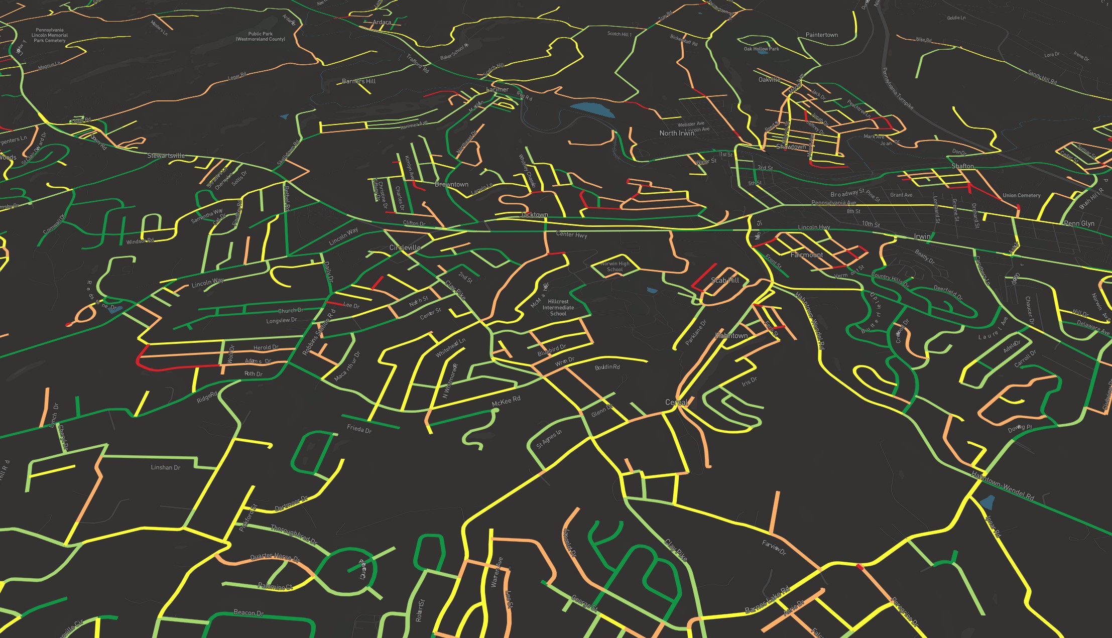
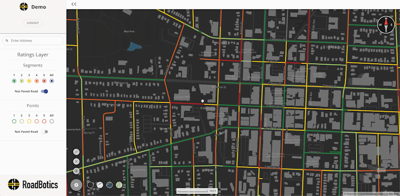
How does the pavement management system work? Roadway data is collected by using a standard smartphone – with RoadBotics’ proprietary data collection app – placed on the windshield of any vehicle. Pennoni has individuals throughout the company that have been trained on the data collection process and the best conditions to receive the most accurate results. The data is then uploaded into RoadBotics’ AI platform where its analyzed against a worldwide database of pavement distresses. Images are gathered in 10-foot intervals and each road is provided a rating based on the condition of the road surface. As an enterprise partner, Pennoni is then provided with a map rating the infrastructure in five color categories with dark green being the best and red being the worst, enabling our engineers to provide analysis on these ratings. Unlike previous methods of pavement analysis that are subjective, this analysis produces a large scale, objective rating that is used to assist our clients in prioritizing pavement maintenance needs.
Once the data and colored map is provided, Pennoni is able to use our geographic information system platform (GIS) or an online interactive map to introduce other data such as daily traffic counts, truck versus car traffic, poor subsurface drainage, municipal wards, previous paving history, etc. in order to do predictive analysis on which roads will deteriorate faster over time. This can be used to advise owners on which roads or parking lots should be prioritized.
Pennoni has used the software analysis in various municipalities and higher education and commercial facilities in Pennsylvania, New Jersey, and Florida. To date, the data has been used for a variety of projects including 5-year road program planning, cost estimates for annual paving projects, objectively prioritizing road maintenance needs, municipal road condition maps, and more.
This partnership provides an innovative and efficient solution to municipalities and private entities looking for objective analysis of their roads, parking lots, and highways using a visualization of the results which can be shared with stakeholders to determine future infrastructure planning needs.
Megan Todaro
If you’re interested in RoadBotics, please contact Megan at mtodaro@Pennoni.com.
Megan serves as a Staff Engineer for Pennoni and works within the Municipal Division assisting Township/Borough Engineers on a variety of projects. She is responsible for project coordination with the RoadBotics enterprise partnership.