Longevity Meets Flexibility
With nearly 60 years of expertise, Pennoni delivers innovative solutions by approaching engineering challenges from a wider angle than most and fostering collaboration to address current challenges and future demands.

Pennoni worked with DelDOT to develop statewide Equity Focus Areas to accurately represent the underserved communities of Delaware. This analysis was conducted in order to make informed investment decisions, provide data for public outreach and engagement strategies and create a standardized tool for DelDOT (and potentially other state agencies) to identify underserved communities as required by HCR40 related to Justice40 (EO 14008). The project workflow focused on aggregating authoritative datasets, running spatial analysis tools in GIS, and producing web applications and Story Maps to share the results with a variety of stakeholders- including the public. Overall, Pennoni supports DelDOT’s Transportation Resilience and Sustainability group by implementing a variety of resiliency and sustainability GIS solutions across the state.
Learn more about the Delaware Equity Analysis Tool here.
Pennoni’s GIS & Asset Management team and our client, the Delaware Department of Transportation Division of Resilience & Sustainability, were honored to receive the 2024 Esri (Environmental Systems Research Institute) Special Achievement in GIS (SAG) Award for our work using GIS (geographic information systems) Analytics and Story Maps to develop this Equity Analysis Tool!
The SAG Award is a prestigious recognition presented by Esri to organizations and individuals who have demonstrated exceptional vision, leadership, hard work and innovation in their use of GIS technology. This award celebrates outstanding achievements in leveraging GIS for various purposes, such as mapping, spatial analysis and data visualization. These awards are presented to organizations worldwide, spanning various sectors such as government, environmental conservation, urban planning, public health and more.

Pennoni’s SR 3006 over Gardner Creek Bridge replacement project, ECMS 8308, was chosen by PennDOT as a Digital Delivery Pilot Project. This project ...
Read More

Newark, NJ Airport – Net Zero/Complete Electrification of Building 1 & Electric Ground Support Vehicle Fleet Conversion Newark Liberty Internati...
Read More

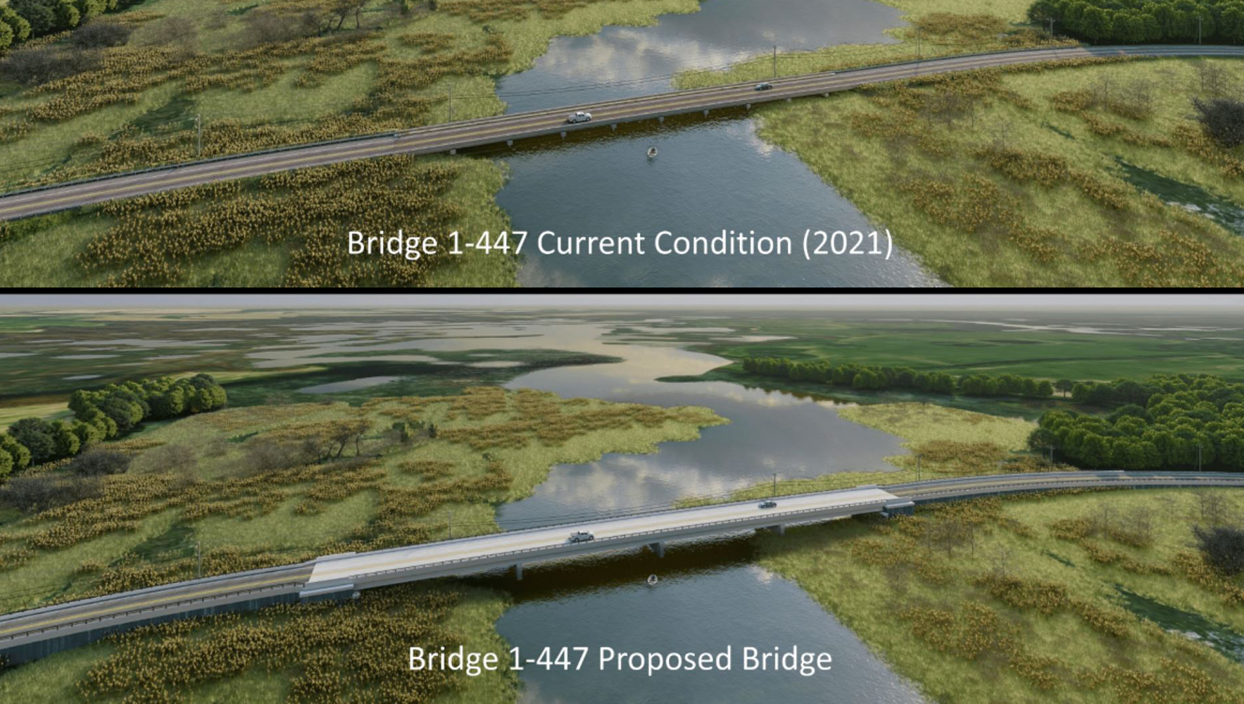
State Route 9 (SR 9) in Delaware is highly susceptible to coastal flooding due to its low elevation and proximity to the Delaware River and Bay. This ...
Read More