Longevity Meets Flexibility
With nearly 60 years of expertise, Pennoni delivers innovative solutions by approaching engineering challenges from a wider angle than most and fostering collaboration to address current challenges and future demands.
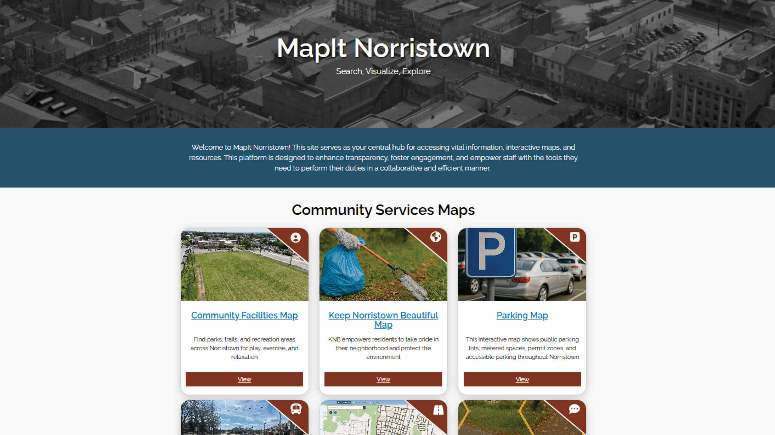
Pennoni’s GIS & Asset Management team partnered with the Municipality of Norristown to create MapIt Norristown, a suite of public-facing GIS maps designed to improve transparency, citizen engagement, and access to municipal services. Accessible directly from the municipal home page, the interactive platform provides residents and businesses with easy-to-use tools to explore planning, zoning, land development, economic development, fire safety, and parking information. The maps also enhance delivery of essential services by sharing real-time details on roadway maintenance, snow removal routes, trash collection schedules, and council member districts. Future phases of the project will expand the system to include interactive dashboards offering insights on code enforcement, police activity, and fire services. By leveraging cutting-edge GIS technology, Pennoni helped Norristown create a powerful digital resource that connects residents to their community and supports more informed decision-making.
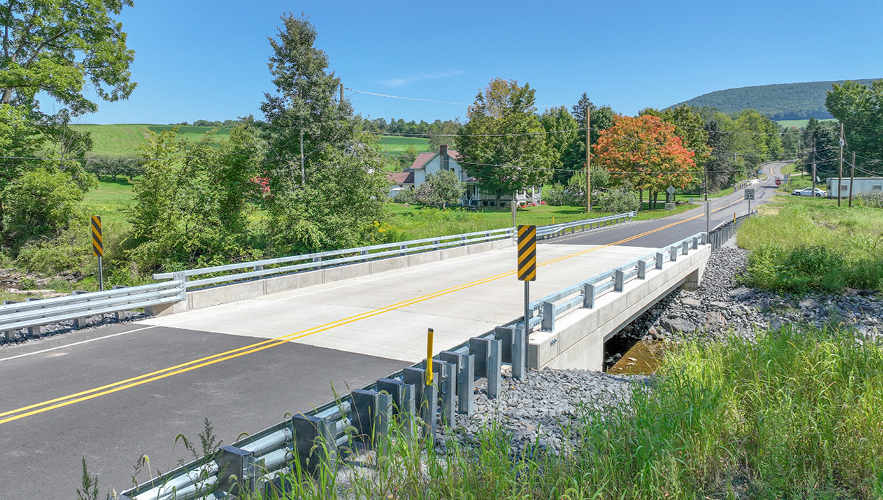
Pennoni’s SR 3006 over Gardner Creek Bridge replacement project, ECMS 8308, was chosen by PennDOT as a Digital Delivery Pilot Project. This project ...
Read More

Newark, NJ Airport – Net Zero/Complete Electrification of Building 1 & Electric Ground Support Vehicle Fleet Conversion Newark Liberty Internati...
Read More
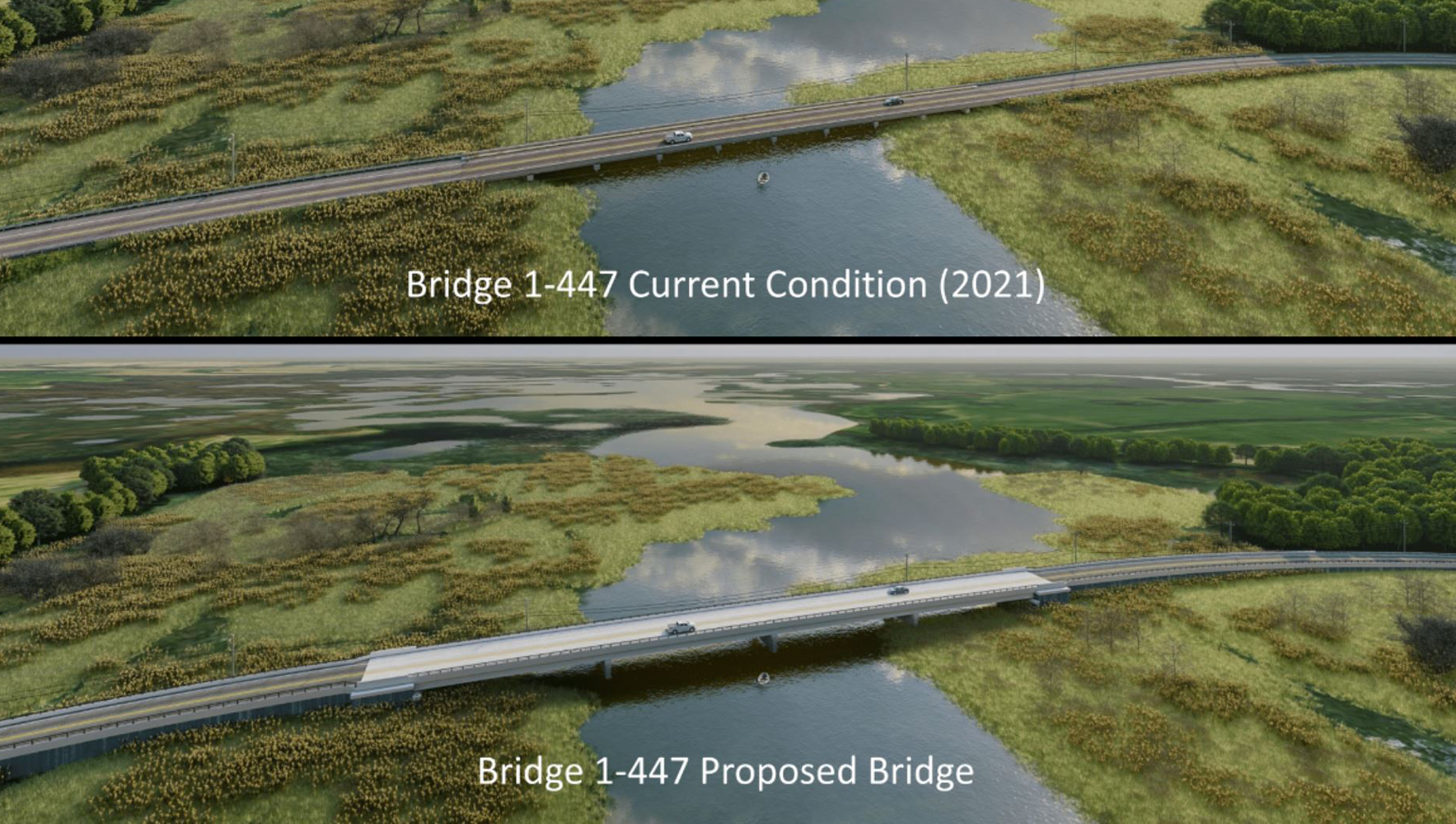
State Route 9 (SR 9) in Delaware is highly susceptible to coastal flooding due to its low elevation and proximity to the Delaware River and Bay. This ...
Read More
With nearly 60 years of expertise, Pennoni delivers innovative solutions by approaching engineering challenges from a wider angle than most and fostering collaboration to address current challenges and future demands.

With 40+ offices, we live, visit, and work in the communities we serve, so we build partnerships to bring the best solutions for the community; not just the best solution.
We continually employ innovation to accomplish more for our clients, using the latest technologies to complement our traditional engineering services.

At Pennoni, we start every project by asking "How will this benefit the community?" Because we are a 100% employee-owned firm, our 1,400+ colleagues put our passion, talent, and value into every project, every day.